
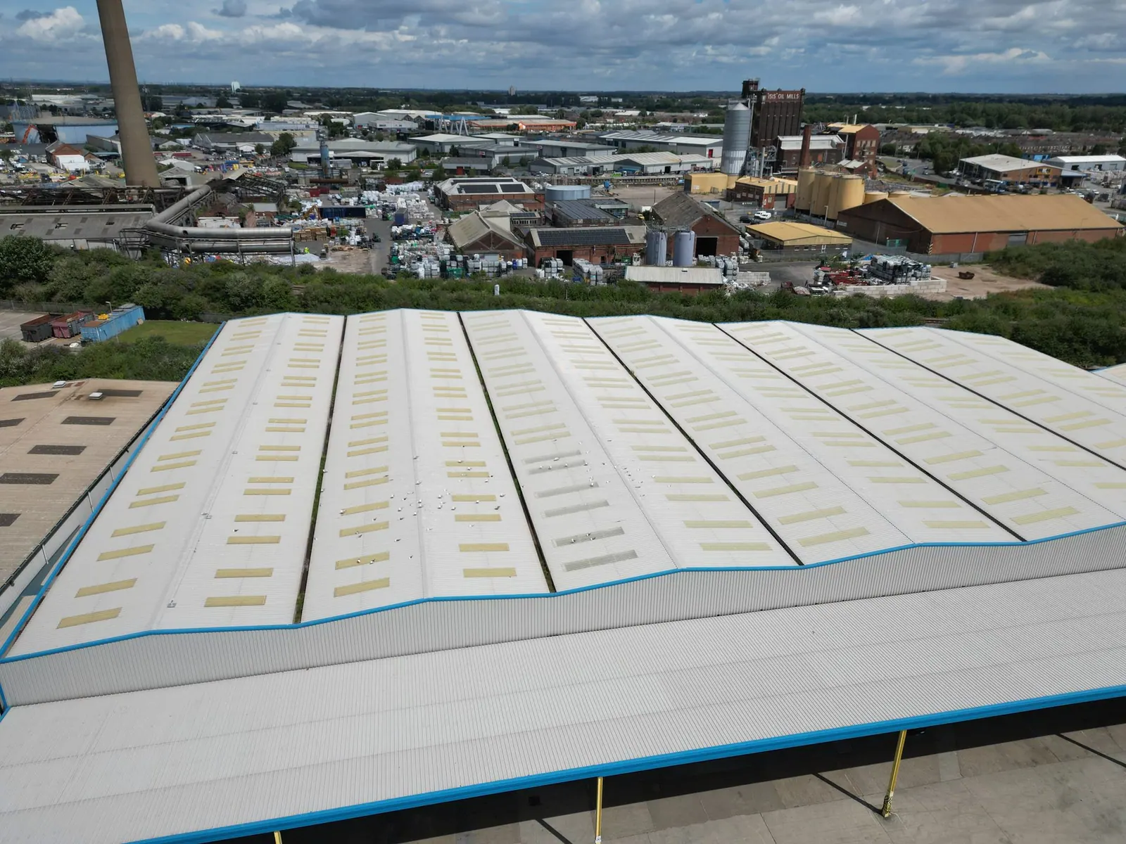
Safer access, clearer information, better decisions
Walker Wood's drone surveys provide high-resolution aerial imagery to support building inspections where access is difficult, unsafe, or disruptive, for example roofs, chimneys, parapets, gutters, and façades. Drones can reduce the need for higher-risk access methods and help inform repair priorities, further investigations, and maintenance planning, particularly where working at height would otherwise be required.
Our drone work is carried out in line with the regulatory and professional expectations that apply to surveying use of UAVs, including current CAA requirements and RICS practice information on drone applications and compliance for surveyors.
Typical uses for drone surveys
Drone inspections are commonly instructed for:
- Roof condition surveys for commercial buildings and heritage assets
- Façade and envelope inspections, including hard-to-reach elevations
- High-level defect capture, for example slips, failed flashings, blocked gutters, cracked parapets
- Heritage recording, where access is sensitive or limited
- Project and development progress recording, supporting monitoring and reporting
- Pre-planned maintenance and repair planning, using consistent imagery to support lifecycle decisions
What you receive
Deliverables are agreed at instruction stage, but typically include:
- A set of dated, high-resolution photographs and, where requested, video footage
- Annotated images highlighting observed defects and areas to monitor
- A concise written summary of observations and suggested next steps, including where closer inspection or specialist testing may be needed
How the process works
- Brief and scope: we agree the objective, areas to be covered, and outputs required.
- Planning: we confirm access arrangements, suitable take-off and landing locations, and any site constraints.
- Flight and capture: we undertake the survey, subject to weather and safe operating conditions.
- Reporting and outputs: we provide imagery and any agreed mark-ups or summary commentary.
Important limitations
A drone survey is a powerful inspection tool, but it is not always a complete substitute for hands-on inspection. Some defects require close access, intrusive opening-up, moisture testing, or internal inspection to confirm cause and extent. We will flag where further investigation is recommended.
If you would like to discuss a drone survey for your project, please contact us.
Frequently asked questions
What is a drone survey?
A drone survey uses an unmanned aircraft to capture high-level imagery and information that supports inspection, condition reporting, and decision-making, particularly where access is difficult or higher risk.
Is a drone survey the same as a building survey?
Not usually. Drone imagery is often one part of a wider inspection. A full building survey may also require internal inspection, close-up access, and further investigations depending on the brief.
Can you fly anywhere?
Drone flying is regulated and depends on airspace, site constraints, and safe operating conditions. The CAA's Drone and Model Aircraft Code sets the rules that must be followed.
How do you manage privacy?
We plan capture to focus on the building and avoid unnecessary recording of people or neighbouring private areas. The ICO provides guidance on drones and data protection which informs good practice.
Do you still need access equipment?
Sometimes, yes. Drone inspection can reduce the amount of access required, but certain details may still need close inspection or safe access methods depending on the defect and building form.